This is the classic way to travel the Pamir Highway: from Dushanbe through the historic Darvoz region, a detour into the remote village of Jizeu, then south along the Afghan border through the spectacular Wakhan Corridor — with its ancient fortresses, hot springs, and views across the Panj River into Afghanistan — before climbing onto the high plateau of the Eastern Pamir through Alichur and Murghab, and finally crossing into Kyrgyzstan to finish in Osh. Compared to the Bartang Valley/Sarez route, this option trades off-road wilderness for a richer mix of history, culture, and dramatic border scenery, while still delivering the same epic high-altitude finale over the Ak-Baital and Kyzyl-Art passes. Altitudes range from around 780m in Dushanbe to 4,655m at the highest pass, so a reasonable level of fitness and time to acclimatize are recommended.
Leaving Dushanbe, the road heads east into the mountains toward the historic Darvoz region — once an independent principality, the "Darvaz Khanate," that controlled this stretch of the Panj River valley until the late 19th century. The regional center is Kalai-Khumb (sometimes referred to simply as "Darvoz"), a small riverside town at around 1,200m where the Panj River marks the border with Afghanistan. Long a Silk Road staging post and later a flashpoint in the 19th-century "Great Game" between Russia and Britain, Kalai-Khumb today is a relaxed overnight stop with a mild microclimate compared to the harsher Pamirs further east — a good first taste of Gorno-Badakhshan before the road climbs higher.
A short driving day followed by a scenic hike into Jizeu (Chizev), one of the most photographed villages in the Pamirs. Jizeu is reached only on foot — a roughly 6 km trail through a dramatic gorge, crossing the Bartang River by cable bridge — and the reward is a cluster of stone houses set among small turquoise lakes formed by a natural dam on the Jizeu River, with views of snow-capped peaks above. There's no road access and no cars, so Jizeu retains a timeless, off-grid feel. Overnight in a village homestay.
Hiking back down to the main road, the route continues to Khorog, the capital of Gorno-Badakhshan Autonomous Oblast (GBAO) and, at around 2,100m, the largest town in the Tajik Pamirs. After days of remote travel, Khorog feels like a proper city — leafy streets, a lively bazaar, restaurants, and the world's second-highest botanical garden. It's also the administrative and logistical hub of the region, so many tours pause here to arrange permits, restock supplies, and visit the Khorog Historical Museum or handicraft shops before heading into the Wakhan.
The road follows the Panj River south toward Ishkashim, hugging the Afghan border the whole way, with Afghan villages, footpaths, and mule tracks visible just across the water. A popular stop en route is the Garm Chashma hot springs, a mineral-rich thermal spring prized locally for its healing properties. Ishkashim itself is a modest border town, historically known for its cross-river Saturday market where Tajik and Afghan traders meet — a rare and fascinating point of contact between the two countries (accessibility of the market varies with the border situation).
This is the heart of the Wakhan Corridor, a narrow strip of Tajik territory squeezed between Afghanistan and the high Pamirs, dotted with ancient fortresses and shrines. Highlights along the way typically include the ruins of Yamchun Fortress, a hilltop stronghold with commanding views over the valley believed to date back over two thousand years; the Bibi Fatima hot springs, said to have fertility-blessing properties; the Sufi Muboraki Wakhoni museum; and Buddhist and pre-Islamic sites near Vrang and Zong. The day ends in Langar, the last major village in the Tajik Wakhan, known for ancient petroglyphs on the hillside above town and as the starting point for treks toward Engels Peak. Overnight in a homestay.
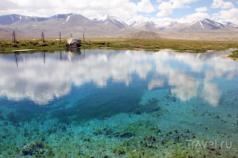
From Langar the route climbs steeply out of the Wakhan over the Khargush Pass (around 4,344m), leaving the Panj River behind and entering the high, empty plateau of the Eastern Pamir. The destination is Bulunkul, a tiny Kyrgyz settlement beside Bulunkul Lake that has the distinction of being the coldest inhabited place in Tajikistan, with winter temperatures plunging far below zero. Nearby Yashilkul ("Green Lake"), formed by an ancient earthquake-triggered landslide much like Sarez, is one of the most beautiful lakes in the Pamirs and worth a stop if time allows. Homes here are heated with dried yak dung, and the tiny community offers a stark, memorable contrast to the greener valleys further west.
Continuing across the high plateau, the route passes through Alichur, a windswept village of scattered houses at around 3,900m, often cited as one of the coldest places in the country and a traditional stop for a yak ride or lunch break. From there the road continues to Murghab (Murgob), Tajikistan's easternmost town and highest major settlement at roughly 3,600m. Founded in 1892 as a Russian frontier outpost during the "Great Game," Murghab today has a mixed Pamiri-Kyrgyz population, a bazaar built from repurposed shipping containers, and a genuine edge-of-the-world atmosphere. Overnight in a guesthouse.
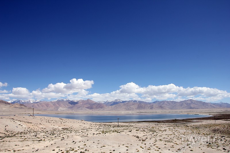
Heading north, the route detours to Rangkul, a striking turquoise lake near the Chinese border known for its saline waters, surrounding sand dunes, and small Kyrgyz village — a good spot for wildlife-watching, with a chance of spotting Marco Polo sheep in the surrounding hills. From there the route climbs over the Ak-Baital Pass (4,655m), the highest point on the entire Pamir Highway, before descending to Karakul, a vast high-altitude lake (nearly 4,000m elevation) formed by an ancient meteorite impact. Karakul's waters shift between deep blue and turquoise depending on the light, and the lakeside village of the same name is the last real settlement before the Kyrgyz border. Overnight near the lake.
The final day crosses the Kyzyl-Art Pass into Kyrgyzstan and descends into the Alay Valley, with sweeping views back toward Peak Lenin (7,134m) on clear days. From the border town of Sary-Tash, a paved road leads the rest of the way to Osh, Kyrgyzstan's second-largest city and a Silk Road trading hub for over three thousand years, home to the UNESCO-listed Sulaiman-Too sacred mountain and one of Central Asia's oldest and most vibrant bazaars. Arrival in Osh marks the end of the tour.