This option is a loop tour, starting and finishing in Dushanbe. It combines the wild, off-road Bartang Valley with the high-altitude lakes and plateau of the Eastern Pamir, before looping back through Khorog and Darvoz to Dushanbe. Expect a real mix of terrain and pace: quiet river-valley villages early on, a long, remote crossing up onto the Pamir plateau mid-trip, and a more "civilized" return leg through Khorog. Altitudes swing from around 780m in Dushanbe to nearly 4,000m at Lake Karakul and higher at the passes in between, so building in time to acclimatize is important. As with any Bartang Valley or Eastern Pamir itinerary, roads are frequently unpaved and travel times can run long — this is a trip for travelers who want remoteness and variety over comfort.
Leaving Dushanbe, the road climbs east into the mountains toward the historic Darvoz region, once an independent principality — the Darvaz Khanate — that ruled this stretch of the Panj River valley until the late 19th century. The regional center, Kalai-Khumb (often referred to simply as "Darvoz"), sits at around 1,200m at the confluence of the Obikhumbob and Panj Rivers, the latter marking the border with Afghanistan. It has a notably milder microclimate than the higher Pamirs further east and makes for a relaxed first overnight stop, with a small fortress, mosque, and riverside views across into Afghanistan.
From Darvoz the route continues along the Panj River valley deeper into Gorno-Badakhshan Autonomous Oblast (GBAO), the vast, sparsely populated province that covers nearly half of Tajikistan. Basid (also spelled Bosid) is a small riverside village used as a staging point before the road turns off into the Bartang Valley. The drive offers classic Pamir scenery — narrow river gorges, terraced fields, and small stone-and-timber villages clinging to the hillsides.
This is where the tour leaves the main road and drops into the Bartang Valley, one of the most remote and least-visited valleys in the Pamirs, following the Bartang River through a narrow, dramatic gorge on an unpaved road. The destination, Savnob, is widely considered the most scenic village in the valley. Its main landmark is a crumbling 19th-century fortress — the source of the village's former name, Tashkurgan, meaning "stone tower." Local legend holds the fortress was built by a craftsman who had lost the use of his right hand after an earlier commission impressed his king a little too much, and so built this one with his left. Savnob is also known for old petroglyphs, a holy spring, and a small natural pool for bathing. Overnight in a village homestay.
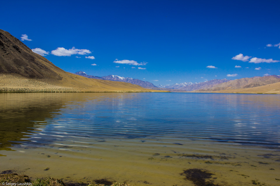
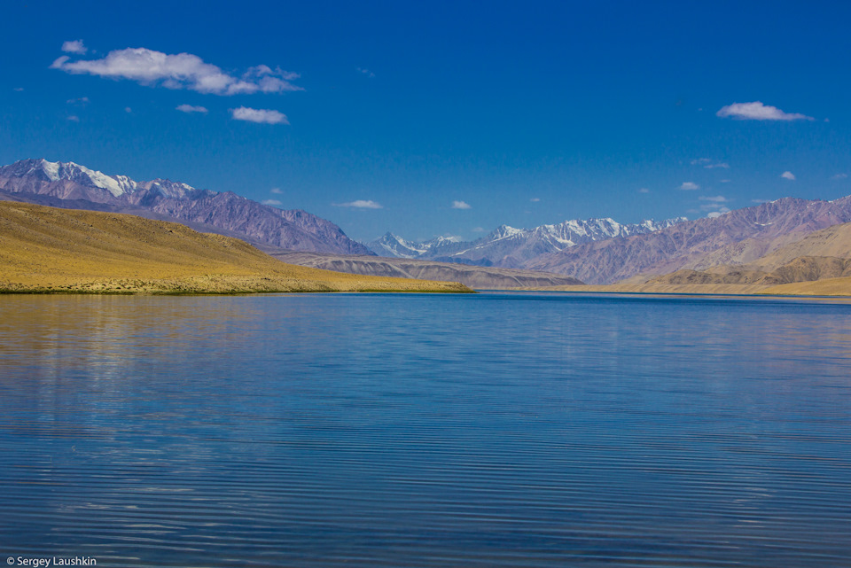
A long and remote crossing day, leaving the Bartang Valley behind and climbing up onto the high plateau of the Eastern Pamir to reach Lake Karakul. Sitting at nearly 4,000m, Karakul is one of the highest lakes in the world, formed by a meteorite impact millions of years ago. Its waters shift between deep blue and turquoise depending on the light, and in winter the lake freezes solid. The small lakeside village of the same name is the last real settlement before the Kyrgyz border on the standard Pamir Highway route, and this leg gives a dramatic sense of the shift from the green, narrow Bartang gorges to the vast, open high-altitude desert of the Eastern Pamir.
Heading back south along the Pamir Highway (M41), the route passes over the Ak-Baital Pass (4,655m) — the highest point on the entire Pamir Highway and a good place to watch for Marco Polo sheep and ibex — before descending to Murghab (Murgob), Tajikistan's easternmost town and highest major settlement, at roughly 3,600m. Founded in 1892 as a Russian frontier outpost during the "Great Game," Murghab today is a small, wind-scoured trading town with a mixed Pamiri and Kyrgyz population and a bazaar built out of old shipping containers — a genuinely edge-of-the-world atmosphere. Overnight in a guesthouse.
From Murghab the route heads back west along the Pamir Highway toward Bulunkul (also spelled Burunkul), a tiny Kyrgyz settlement beside Bulunkul Lake that has the distinction of being the coldest inhabited place in Tajikistan, with winter temperatures dropping far below zero. Homes here are heated with dried yak dung, and the small community offers a stark, memorable window into life on the high plateau. Nearby Yashilkul ("Green Lake"), formed by an ancient earthquake-triggered landslide, is one of the most striking lakes in the Pamirs and worth a stop if time allows. Overnight in a guesthouse.
Leaving the high plateau behind, the road descends gradually toward Khorog, the capital of GBAO and the largest town in the Tajik Pamirs, at around 2,100m. After days on remote roads, Khorog feels like a proper city — tree-lined streets, a lively bazaar, restaurants, and the world's second-highest botanical garden. It's also the region's logistical hub, a good place to restock, relax, and visit the Khorog Historical Museum or local handicraft shops before heading back toward Dushanbe.
Retracing the Panj River valley westward, the route returns to Darvoz/Kalai-Khumb, passing back along the dramatic gorge scenery of the Afghan border with views of Afghan villages and footpaths across the river. It's a long driving day, but one that brings the loop full circle — a chance to reflect on how different the Bartang Valley, the Eastern Pamir plateau, and the Panj River valley all feel from one another, despite being part of the same province. Overnight in Kalai-Khumb.
The final leg heads back over the Shurobod Pass and down through Kulob toward Dushanbe, generally with a stop to see the Nurek Reservoir dam and the Hulbuk fortress and museum in Vose along the way. Arrival back in Dushanbe marks the end of the loop.